42 Days-450 Miles on the Continental Divide
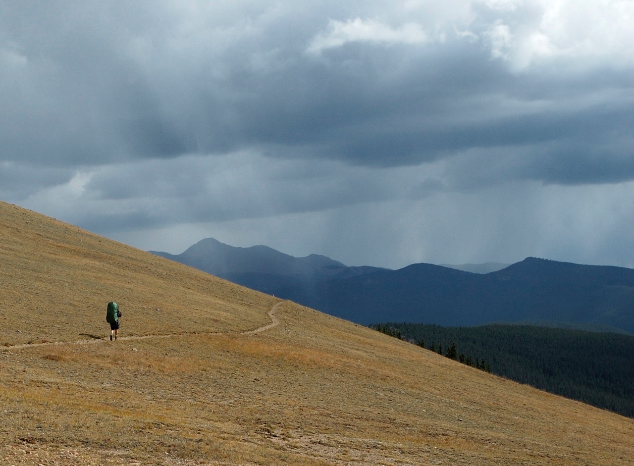
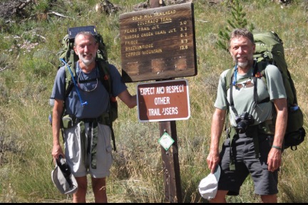
In addition to the oft-repeated “Wow!” at the incredible mountain vistas, the rewards of our trek include a deepened life perspective. Photo courtesy of Paul Hedquist.
by Paul Hedquist
There are many ways to experience the grandeur and majesty of the Colorado Rockies: driving through them, picnicking, skiing or snowshoeing are all great options. But, for the truly curious and adventurous, nothing can compare to a multi-day backpacking trek. As hiking expert Tom Lorang Jones wrote: “It’s the wildest place left in this country.”
For 42 days, 450 miles and an18-mile elevation gain, my brother Pat and I trekked along the Colorado Continental Divide Trail. Our trip ranks as one of the most memorable travel experiences of our lives.
A YEAR TO PREPARE
Our adventure was nearly a year in the making. We studied books about the trail, especially Tom Lorang Jones’ Colorado’s Continental Divide Trail: The Official Guide. We searched the internet for information, analyzed topographical maps and refreshed our decades-old Boy Scout knowledge of first aid, map reading and compassing.
We decided our route would follow the Continental Divide Trail (CDT) as it passes through Colorado. In 1978, this spectacular trail was designated by Congress as the third and, at the time, the longest National Scenic Trail, following the Divide from Canada to Mexico. In Colorado, the 735-mile section includes the highest altitudes of all the designated trails, often climbing above 13,000 feet and, at times, above 14,000 feet.
To prepare physically, we spent many months working to get into optimal cardiovascular shape. Pat, who is 65, loaded his backpack with rocks and repeatedly climbed up and down the 110 steps of Eagle Tower in Peninsula State Park near his home in Wisconsin. At 63, I capped off my regular training with a five-night backpacking trip in the Rocky Mountains a couple of weeks before our start date.
We developed meal plans, trying out various recipes that would yield the most calories in the least possible bulk and weight. We then cooked, dehydrated and vacuum-packed enough food for eight weeks, the maximum amount of time we anticipated being on the trail. Of course, we couldn’t possibly carry all that food, as well as the stove gas, toiletries and the like that would be required for the entire trek. We needed to identify resupply locations at manageable frequencies along the route—U.S. Post Offices, General Delivery—to which our spouses would ship these supplies for each following segment.
Based on our research, we learned that the opportunities for being resupplied between 7-10 days of trekking are limited, and not always convenient. Though the trail passed through some towns (Grand Lake, Twin Lakes, for example), our access to other resupply locations would be dependent upon hitchhiking from mountain passes to towns 14 – 25 miles away. And, our boxes needed to be mailed by our spouses so that the supplies would be waiting for us at each post office upon our arrival.
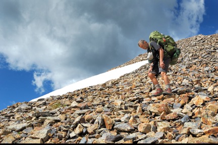
Topographical maps don’t represent how rocky sections of trails can be.
Photo courtesy of Paul Hedquist.
ON THE TRAIL AT LAST!
Finally, with food supplies, routing guides, GPS, and other essential equipment in place, we started off Sunday, August 7. The following entries from my journal provide a flavor of our trek:
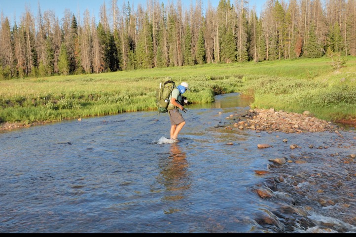
Getting to our second campsite was quite a challenge – Pat crosses the North Fork, Elk River. Photo by Paul Hedquist.
DAY 4 – Wednesday, August 10th
Today started with a steady, sometimes steep ascent to North Lake. A creek at the east end provided us an opportunity to fill up with water, which we would need. Following the juncture with the Wyoming Trail, we headed south across two very large, marsh-like meadows, still wet from the melt off of last winter’s record snowfalls up here. Later, from the summit of Lost Ranger Peak, the many meadows below looked like golf course fairways sculpted through the groves of pine trees. The ascent up Lost Ranger Peak was slow and arduous, being only our fourth day on the trail, and climbing at roughly two vertical miles above where Pat lives. He did magnificently, however. We went purposefully slow, stopping often for him to catch his breath. But I was amazed at his quick recovery. He is strong and clearly in very good cardiovascular shape.
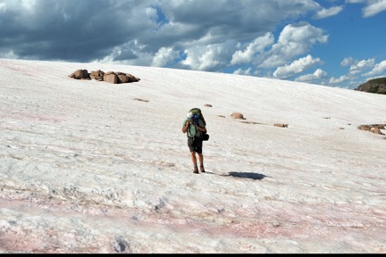
At one point, the trail came to a stop at the foot of a huge snowfield. Pat scanned the horizon with his binoculars and spotted a rock cairn on the other side. We hiked a good quarter mile across the snow to resume the trail. Later, we saw a large snow overhang on Craig Peak, first in the distance to our south, finally (miles later) at our right shoulder as we passed beyond it. We had decided to camp at Lake Elbert, but instead of hiking down to it and back up tomorrow, we’re camping at a high point about three-quarters of a mile above the lake. We’re at 11,240 feet after a day that had us gain 5,458 feet in elevation (yes, more than a mile up!).
DAY 5 – Thursday, August 11
The thoroughness of planning is often belied by the reality and rigor of doing. So it is for us. This first week, we’re learning what, perhaps, should have been obvious about the limitations of topographical maps: they aren’t intended to represent how rocky sections of trails can be; how greatly hiking conditions are affected by such things as trees fallen across the trail, mud from rains and melting snow, even from large snowfields leftover from the previous winter; nor how often the trail is completely unmarked and indiscernible.
Sure, we knew in advance that we’d be hiking up and over ridges, down into creek beds, and over mountain passes. But several years of bark beetle infestations too often have us climbing over, crawling under or hiking around fallen trees; in the north, leftover snow from record snowfall amounts the preceding winter have us navigating across large snowfields, and hiking through meadows wet from snowmelt; and the absence of trail markings has us relying on our GPS waypoints, map and compass skills—all of which significantly impede our progress against our plan.
Day 7 – Saturday, August 13th
A change in plans. Pat and I had originally set out to trek the entire portion of the Colorado Continental Divide Trail, from Wyoming to New Mexico. But, this first week, we realized that trail conditions are forcing us to put in longer-than-planned days of actual hiking, taxing our energy reserves and eroding our sense of excitement and adventure. By the time we reach our first resupply location, Steamboat Springs, our fixation on our daily “quota” of miles, despite trail conditions, is noticeably draining our enjoyment of the scenery and our experience, overall. Our adventure, early on, is becoming a chore.
Through an honest conversation, Pat and I made the mental adjustment to jettison New Mexico as our objective, instead we are prioritizing the appreciation of each day. We’re reducing our daily mileage, selecting each day’s planned campsite the night before, based on our on-the-ground awareness of local conditions. An important result of fewer hours committed to hiking each day is more leisurely mornings and evenings, a less hurried hiking pace and, overall, positive memories of a great experience together.
Day 10 – Tuesday, August 16th
Our hard work of carrying 50+ pounds on our backs is compensated each day by spectacular scenery and a nightly sense of accomplishment. Pat aptly describes an essential aspect of the trek: “Each day we pack up our entire house, hoist it onto our backs and hike to our next location. There, we unpack our house for the night, to repeat the process the next day.”
Day 20 – Friday, August 26th
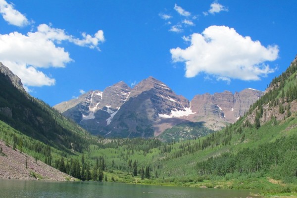
In addition to the oft-repeated “Wow!” at the incredible mountain vistas, the rewards of our trek include a deepened life perspective. This is so each time I backpack into the mountains, but is especially true on this extended journey. My sense of place in the world and acceptance of my mortality is renewed as, at our many campsites, I observe the natural cycle of life all around: seedling pines, saplings and tall mature trees, all growing out of the rich, moss-covered soil of decayed and decaying previous generations of trees. From the tops of mountain passes and the occasional high peak, I renew my awareness of my own smallness and transitoriness.
Amidst the vast agelessness of the mountains, I’m reminded that the things over which I too-often stress are mere moments in time, as are the totality of my own moments. Together, we’ve come to be grateful for past leaders who vouched safe the opportunity to explore millions of acres of wilderness, and to fellow trekkers who abide by the Leave No Trace principle: “Leave only footprints; take only pictures.”
Day 30 – Monday, September 5th – Labor Day
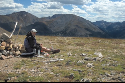
Today turned out to be one of our more challenging hikes. We departed our campsite just south of Twin Lakes and climbed 4.5 miles up Little Willis Gulch to the top of Hope Pass. It was a quick ascent of more than 3,300 feet, our packs heavy from having just resupplied at Twin Lakes. Despite a cold northerly wind at the Pass, we stopped for lunch, enjoying the most remarkable vistas of the entire trek to date. In all directions were spectacular mountain views. We were truly in the middle of the Rockies. From the Pass, we had a quick descent of more than 2,800 feet to Clear Creek, along which we hiked for another 2.5 miles to our campsite. We were both achy from the day’s steep descent, but proud of what we had accomplished.
Day 35, Saturday, September 10th
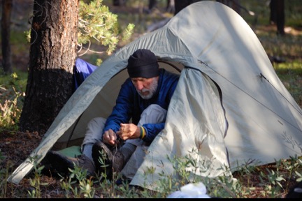
Spending multiple weeks together, 24/7, with the added challenges inherent in trekking, underscores the importance of carefully selecting one’s trekking partner(s). For Pat and me, being brothers was no guarantee that our many days together would not result in disharmony, particularly since the two of us had gone our separate ways as adults, separated by hundreds of miles, seeing each other only at the occasional family gathering. In our case, the result could not have been better. We are highly compatible, hiking at the same comfortable pace (actually, even the same stride), needing breaks at the same time, enjoying the same humor, and comfortable with long periods of silence. We’ve realized, as the days pass, that neither of us could have done what we are doing with anyone else.
Day 42, Saturday, September 17th
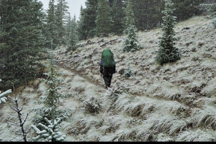
This is the end of our sixth week on the trail. We awoke at our campsite along Spring Creek, just west of San Luis Pass and east of San Luis Mountain. We slept at 12,050 feet. Our tents and pack were covered with frost, so we took the time to hang lines to dry them out. Within an hour of our departure, the sky clouded over, so we put on our rain gear—only, this time, no rain. Snow!
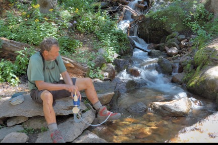
We were in blizzard-like conditions part of the two hours it snowed. When we stopped for lunch, snow covered us, the ground, trees and plants all around us. As we ate, the sky magically began to clear, revealing a most wonderful blue sky and sunlight that warmed us inside and out. Our destination was another 90 minutes away, at 12,310 feet. When we arrived, the sun was already beginning to set behind the peaks to our west. By the time we’d set up camp, pumped water, hung ropes to suspend our food and had dinner, the water in our bottles was already freezing. We knew we were in for a very cold night.
END OF THE TREK
With the advent of autumn in the high country, snow and fatigue, our trek ended on Day 42, at Spring Creek Pass, south of Lake City, Colorado. The next segment of the trek would have taken us 110 miles, through the Weminuche Wilderness and the San Juan Mountains, to Wolf Creek Pass near Pagosa Springs. This stretch is described as one of the most beautiful sections of the entire Continental Divide Trail. That has us both “curious.” So, if you’re hiking in that area in the late summer, keep an eye out for us!
Paul Hedquist lives with his wife, Meg Altmix, in Loveland, Colorado. His brother, Pat Hedquist lives with his wife, Susan, in Fish Creek, Wisconsin. Paul writes that their amazing trek may have been “inevitable, given that our dad had taught us to respect and appreciate the wonders and challenges of the outdoors, and seeded our love of camping with annual family camping trips around the country. Pat had long yearned to trek the Appalachian Trail, and I the Continental Divide Trail. As fairly independent, introverted persons, however, neither of us had given much thought to attempt such a feat with someone else, and our spouses had wisely counseled against either attempting a solo trek. A chance discussion of how our long-held dreams of trekking a National Scenic Trail were fading with advancing age, resulted in a shared vision of engaging in such a challenge together.”


